Every Adventure Starts Somewhere!
Join the Absaroka-Beartooth Wilderness Foundation as we share the latest updates on all the great Trailheads across our beloved Wilderness area. We will posting new trailheads every week or so throughout 2024.
These “Trailhead Inventories” will include all the information you need to reach your launch spot, amenities available (or not), just how far it is to that iconic Wilderness sign, and more.
Looking for ideas or a new location for an upcoming weekend adventure, follow along and don’t miss a single Episode as we spend the summer visiting Wilderness portals from Red Lodge, Livingston, Cooke City, Yellowstone Park, Beartooth Highway, Nye, the Boulder River and every stop in between.
EPISODE 1 – Suce Creek/North Fork Deep Creek
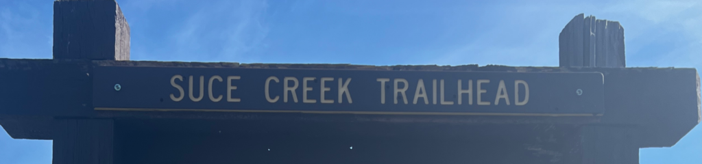
Located at the very northwest corner of the Absaroka-Beartooth Wilderness, this easily accessible Trailhead (TH) is a popular portal for both mountain bikes and remote Wilderness seekers. Between December 1st and March 31st, the road is gated and usually drifts a mile or two from the end, but is often accessible year-round and popular with winter skiers and hikers. As always, grizzly bears may be common from March through November and moose are also present year-round. Don’t forget the bear spray.
STATS:
Custer Gallatin National Forest District: Yellowstone District Ranger Station
5242 US-89, Livingston, MT 59047
Phone: (406) 522-1892
Distance from Hwy: 5.6 miles from US Highway 89 via East River Road (MT 540) and Suce Creek Road #201. Less than 30 minutes from Livingston, MT. Gravel road with no added clearance necessary. Expect deep snow and drifts in winter, bring shovels. Google Maps Pin for the Parking Lot
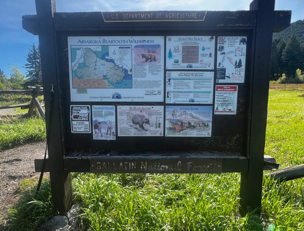
Amenities: Vault toilet. Remember to never throw garbage of any kind into the vault toilets. This includes dog poop bags. These items make it very hard to empty, which leads to closed toilets.
There is parking for up to 20 vehicles. Turn-around suitable for most horse trailers. Two Bulletin Boards. There is a lovely picnic area in the aspens with 2-3 tables that are being improved in June 2024.
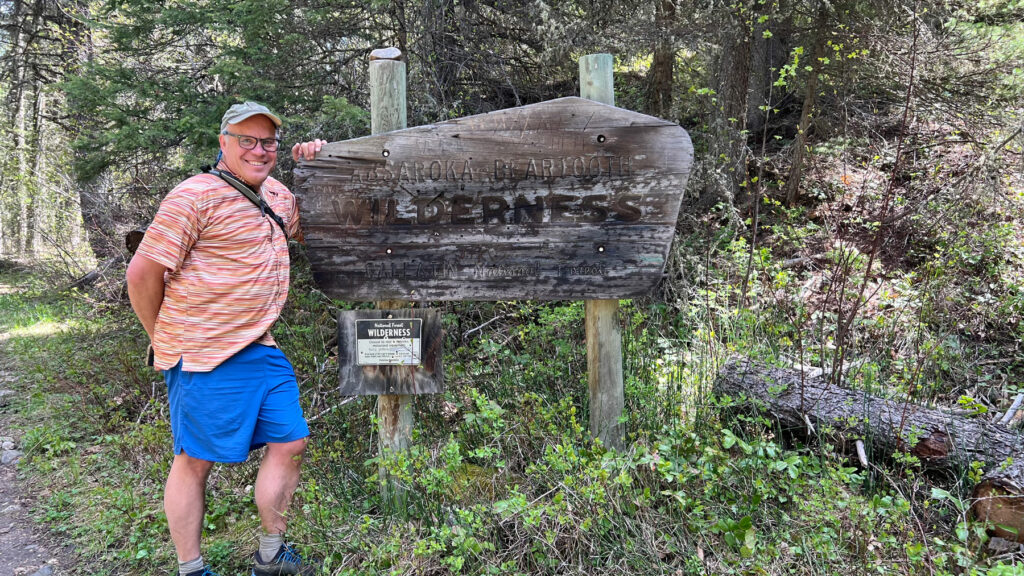
Wilderness Trails: One-tenth of mile out of the parking lot, the trail forks. To the right is the steep North Fork of Deep Creek Trail #45 (foot and stock only). The Wilderness boundary is just over a quarter mile away, just as the trail enters thick forest, but there is no sign (as of June 2024). This trail climbs steeply through the forest before providing rare views of Deep Creek and the alpine backside of Elephant Head Mtn. This trail can be turned north into an epic loop hike/run or taken south and east as far as your legs and time will allow.
From the fork near the TH, straight ahead is the gentler Suce Creek Trail #44 which splits again after a half mile, just across the creek. West Suce Creek Trail #450 on the left is open to mountain bikes. Trail #44 goes right up the creek for 0.3 miles to a unique horizontal Wilderness sign. This trail follows the Wilderness boundary along Suce and Lost Creeks to create a pleasant 6.1 mile lollipop loop returning on Trail #450 after climbing to the upper Livingston Peak Trailhead which, will be featured on a future “Wilderness Portal” episode.
Don’t forget your bear spray! Despite the area’s popularity and being close to town, grizzly bear sightings are common.
MAPS: The nice loop created by Trail #44/450 to the upper TH does not appear on many maps including the popular Beartooth Publishing Maps, nor is it on the map often found on the trailhead sign. Don’t stress, it is there! Go explore and have an adventure.
Next Nearest Trailhead: South Fork of Deep Creek
EPISODE 2 – South Fork Deep Creek
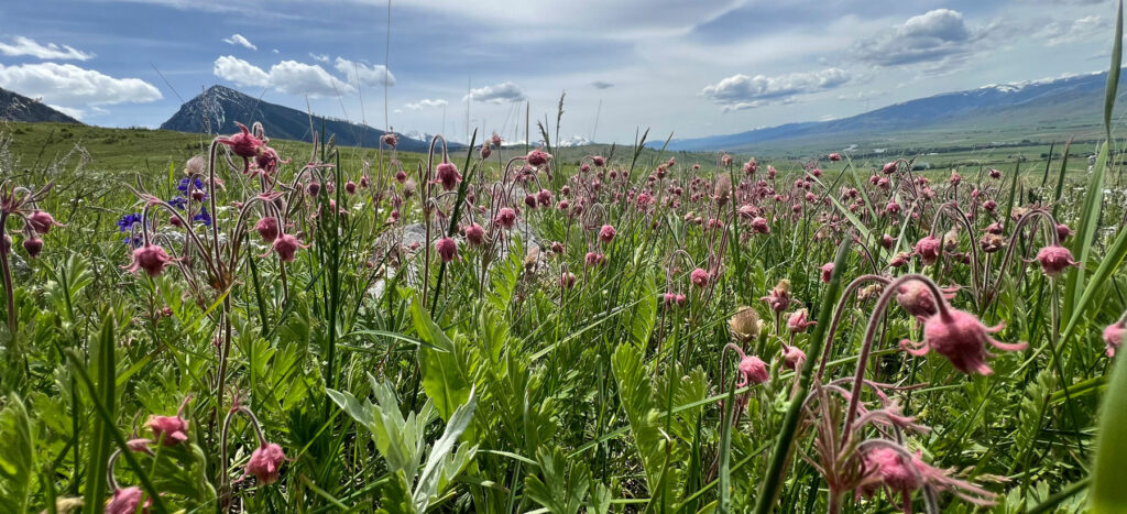
Thanks to a sunny aspect and year-round access, the (South Fork) “Deep Creek” Trail #38 is is one of the “go-to” short hike venues for locals. The dramatic Pine Creek Fire of 2012 drastically changed this forested canyon into a sunny, open valley, making it a good early season or cool weather outing with great meadow wildflowers in the spring.
As always, grizzly bears may be common from March through November and moose are also present year-round. Don’t forget the bear spray.
STATS:
Custer-Gallatin National Forest District: Yellowstone District Ranger Station
5242 US-89, Livingston, MT 59047
Phone: (406) 522-1892
Trailhead Location Google Maps Pin
Distance from Hwy: 1.55 miles from East River Road (MT 540), 2.84 miles south of the Suce Creek Road #201. Less than 30 minutes from Livingston, MT. Gravel road with no added clearance necessary. The road may drift during bad storms but is often passable in winter.
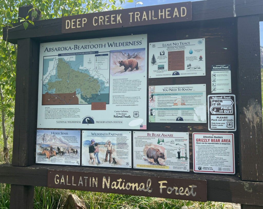
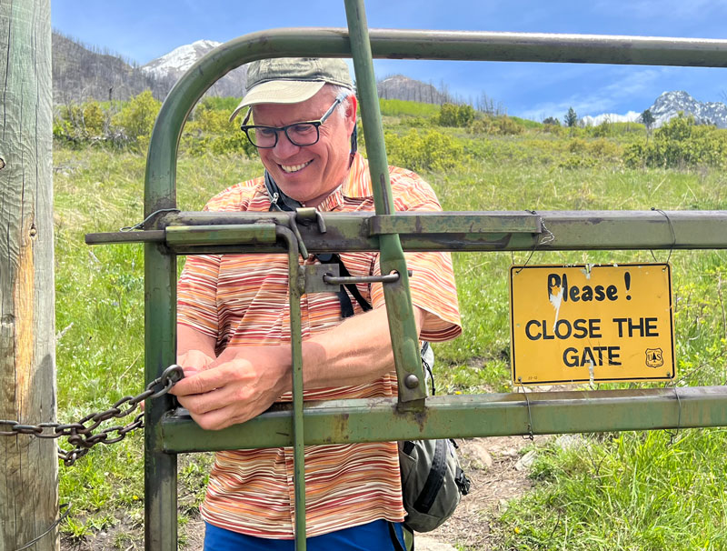
Amenities: No outhouse or garbage service. Parking in a small area for up to 12 vehicles (if everyone parks nicely). NO turn-around for horse trailers. One Bulletin Board. Please close any gates behind you.
Camping Sites: None.
For more information on nearby dispersed camping visit Custer Gallatin National Forest web site
Popularity: With spectacular views of northern Paradise Valley, this Wilderness portal is open and sunny, easy to get to, and beautiful. Ever popular with the locals out for a quick dog walk, it can get crowded on a weekend up to the first bridge, but the rugged trail leading to the Wilderness boundary and beyond is rarely traveled.
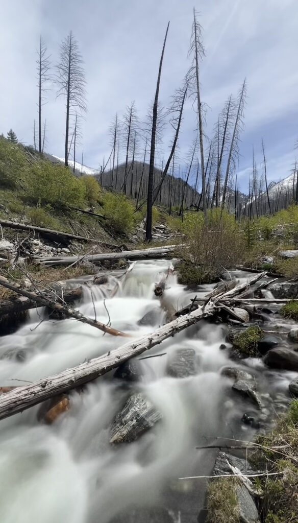
Wilderness Trails: It is a solid mile and a half to the Wilderness boundary, just above the switchback. If there was ever a Wilderness sign, it burned up in the 2012 fire and hasn’t been replaced as of June 2024. If you are looking for a “destination,” another mile past the boundary is a lovely spring near the trail. The crystal water bubbling up created a lush, fairy wonderland before the fire and was dubbed the “fountain of youth” by locals. The indomitable water spirit remains as the spring continues to revitalize the area post-fire. Overall, the trail is 5.4 miles to the Deep Creek-Davis Creek (West Boulder) divide and is a worthwhile out-and-back or as a launch spot to summit Mount McKnight (10,310’) and beyond.
Next Nearest Trailhead: Everyone’s favorite – Pine Creek